MY SEARCH ENGINE

Monday, April 19, 2021

Mars Helicopter Takes Flight & More to Come

Get students engaged in the history-making event and explore more upcoming events! 
video

Today, NASA made history with the first helicopter flight on Mars! (Watch the Ingenuity Mars helicopter's flight unfold in the video above, which was recorded by the Perseverance rover.) Students can "dare mighty things" right along with the engineers who made the flight a success. First, watch the student talk below to hear from NASA experts about what went into designing a helicopter for Mars, then explore related activities to get students engaged in their own engineering challenges and our ongoing exploration of Mars.

Plus, don't miss our upcoming events for educators and students. This month, hear more from the Mars helicopter team and discover how you can celebrate Earth Day with educational resources from NASA. In May, meet experts exploring planets beyond our solar system, and in June, learn how we study and track asteroids.

Talk for Students: Experts Discuss NASA's Mars Helicopter

TALK FOR STUDENTS

Experts Discuss NASA's Mars Helicopter

Join NASA experts to learn about Ingenuity, the first helicopter to fly on Mars. We share what went into Ingenuity's historic first flight and how to follow along with resources from NASA.


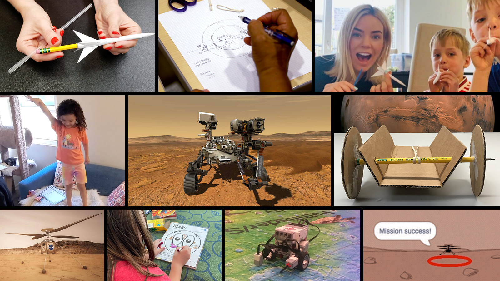
Related Activities & Lessons

Student Project: Make a Paper Mars Helicopter
Student Project: Code a Mars Helicopter Video Game
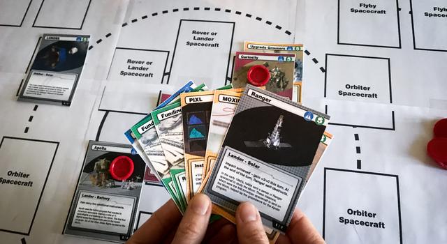
Educator Guide: NASA Space Voyagers: The Game
Student Slideshow: NASA Pi Day Challenge

Upcoming Events

Public Event: Celebrate Earth Day With Education Resources From NASA

Public Event

April 22, All Day

Explore lessons and activities from NASA/JPL Edu to engage students in Earth Day on April 22.

Webinar: Taking Flight: How Girls Can Grow up to Be Engineers – Internships and Other Opportunities

Public Event

April 22 & April 29 at 1 p.m. PDT

Meet female engineers working on the Mars helicopter at NASA-JPL, who will explain how they got their start – and how you can, too.

Webinar: Teaching Space With NASA Live Stream – The Search for Exoplanets

Public Event

May 5 at 3 p.m. PDT

In this educational live stream, NASA experts will discuss how we look for planets outside of our solar system. Plus, we'll answer your questions!

Webinar: Teaching Space With NASA Live Stream – Tracking Asteroids

Public Event

June 9 at 3 p.m. PDT

In this educational live stream, NASA experts will discuss how we track and study comets and asteroids. Plus, we'll answer your questions!

Explore More

Educator Resources: NASA's Mission to Mars Student Challenge

Educator Resources

Student Activities: Learning Space With NASA at Home

Student Activities

Live Streams

Live Streams: Teaching Space With NASA

Educator Resources

Teachable Moments

Educator Resources

STEM Lessons for Educators

Student Activities

STEM Activities for Students
 
@NASAJPLedu Facebook@NASAJPL_Edu TwitterJPL Education Website@NASAJPL_Edu Instagram@nasajpledu YouTube

Day in Review


DAY IN REVIEW
NASA’s Ingenuity Mars Helicopter Succeeds in Historic First Flight
The small rotorcraft made history, hovering above Jezero Crater, demonstrating that powered, controlled flight on another planet is possible.
› Read the full story
NASA’s Ingenuity Mars Helicopter Successfully Completes First Flight
The Ingenuity team at NASA’s Jet Propulsion Laboratory in Southern California determined that the flight was successful after receiving data from both the helicopter and the Perseverance Mars rover.
› Watch now


Saturday, April 17, 2021

Day in Review


DAY IN REVIEW
The Ingenuity Mars Helicopter’s carbon fiber blades can be seen in this video screenshot taken by the Mastcam-Z instrument aboard NASA's Perseverance Mars rover on April 8, 2021, the 48th Martian day, or sol, of the mission.
NASA to Attempt First Controlled Flight on Mars As Soon As Monday

A livestream will begin at 3:15 a.m. PDT that morning as the helicopter team prepares to receive the data downlink at NASA’s Jet Propulsion Laboratory.

NASA is targeting no earlier than Monday, April 19, for the first flight of its Ingenuity Mars Helicopter at approximately 3:30 a.m. EDT (12:30 a.m. PDT).

Data from the first flight will return to Earth a few hours following the autonomous flight. A livestream will begin at 6:15 a.m. EDT (3:15 a.m. PDT) as the helicopter team prepares to receive the data downlink in the Space Flight Operations Facility at NASA’s Jet Propulsion Laboratory (JPL). Watch on NASA Television, the agency app, website, and social media platforms, including YouTube and Facebook.

If the flight takes place April 19, a postflight briefing will be held at 2 p.m. EDT (11 a.m. PDT).

The participants are:

  • Thomas Zurbuchen, associate administrator of NASA’s Science Mission Directorate
  • Michael Watkins, JPL director
  • MiMi Aung, Ingenuity Mars Helicopter project manager at JPL
  • Bob Balaram, Ingenuity Mars Helicopter chief engineer at JPL
  • Håvard Grip, Ingenuity Mars Helicopter chief pilot at JPL
  • Justin Maki, Perseverance Mars rover imaging scientist and deputy principal investigator of Mastcam-Z instrument at JPL

The public also may ask questions on social media during the livestream and briefing using #MarsHelicopter.

Find the latest schedule updates at:

https://mars.nasa.gov/technology/helicopter/#Watch-Online

The original flight date of April 11 shifted as engineers worked on preflight checks and a solution to a command sequence issue. The rover will provide support during flight operations, taking images, collecting environmental data, and hosting the base station that enables the helicopter to communicate with mission controllers on Earth.

This technology demonstration is supported by NASA’s Science, Aeronautics Research, and Space Technology mission directorates. JPL, managed for NASA by Caltech in Pasadena, California, built and manages operations for Ingenuity and the Mars 2020 Perseverance rover.

Follow Ingenuity via the @NASA, @NASAJPL, and @NASAMars Twitter accounts; NASA and NASAPersevere Facebook accounts; and NASA Instagram account.

An Ingenuity press kit is available at:

https://go.nasa.gov/ingenuity-press-kit


Thursday, April 15, 2021

Day in Review


DAY IN REVIEW
Data collected with the Global Airborne Observatory over the Permian Basin in 2019, a joint campaign with NASA’s AVIRIS-NG.
NASA-Built Instrument Will Help to Spot Greenhouse Gas Super-Emitters

The tool will help people, including resource managers and other officials, to address increasing concentrations of methane and carbon dioxide in the atmosphere.

NASA’s Jet Propulsion Laboratory in Southern California is providing the instrument that will enable a nonprofit organization called Carbon Mapper to pinpoint and measure methane and carbon dioxide (CO2) point-sources from space. The data collected by the instrument will help to find super-emitters – the small percentage of individual sources that are responsible for a significant fraction of global emissions of methane and carbon dioxide.

“JPL is excited to be pioneering this research effort, which will provide critical information about greenhouse gases and the future of Earth’s climate,” said James Graf, director for the Earth Science and Technology Directorate at JPL. “This effort is the first time we have partnered on a space mission with a consortium of nonprofit organizations, universities, and the State of California.”

The first Carbon Mapper satellite is targeting a 2023 launch. JPL will provide a state-of-the-art imaging spectrometer, a type of instrument used widely in scientific research. Where a digital photograph breaks down visible light into just three colors – red, green, and blue – an imaging spectrometer breaks down light into hundreds of colors to reveal the unique spectral signatures of molecules such as methane and carbon dioxide in the air.

JPL has been developing imaging spectrometers since the 1980s for NASA, and its instruments have unmatched performance. In the last few years, the laboratory has used these imagers deployed on airplanes to measure atmospheric gases, including methane in California and the Four Corners region of the U.S. JPL imaging spectrometers will also be aboard upcoming missions to the Moon and Jupiter’s moon Europa.

The Carbon Mapper’s Earth-orbiting imaging spectrometer will have a pixel size of about 30 meters (98 feet) square. Other imaging spectrometers currently in orbit have larger pixel sizes, making it hard to pinpoint the locations of sources that may not be visible on the ground, such as cracks in natural gas pipelines. “With such high-resolution images, there is no question where greenhouse gas plumes originate. This technology enables researchers to identify, study, and quantify the strong gas emission sources,” said JPL scientist Charles Miller, who has spent decades studying methane around the world.

JPL’s research in methane quantification from spectroscopy, funded by NASA’s Earth science division, is also helping Carbon Mapper to address a second challenge: making its data on emissions accessible to all interested users in industry, government, and the private sector. Carbon Mapper will have an open data portal making its findings available quickly and continuously, speeding disaster responses and the repair of faulty industrial equipment.

“This decade represents an all-hands-on-deck moment for humanity to make critical progress in addressing climate change,” said Riley Duren, Carbon Mapper’s chief executive officer and a research scientist at the University of Arizona in Tucson. “Our mission is to help fill gaps in the emerging global ecosystem of methane and CO2 monitoring systems by delivering data that are timely, actionable and accessible for science-based decision making.”

NASA’s Earth science division pioneers technological innovations that propel observations and scientific understanding of the changing Earth system. Besides JPL, other Carbon Mapper partners are the State of California, Planet, the University of Arizona, Arizona State University, High Tide Foundation, and RMI. For more information on Carbon Mapper, its satellites, and its partners, visit:

http://www.carbonmapper.org/


WATCH LIVE TONIGHT: Science on Ice - Apr 15 at 7:00 p.m. (PT)

Von Karman Lecture Series - April 2021
NASA JPL Von Karman Lecture
Science on Ice: What Ice Says About Past, Present, and Future Climate

Celebrate Earth Day with us as we explore the world’s ice and what it can tell us about our climate. We’ll talk with scientist Alex Gardner about our cryosphere and how it affects our future.

More details

Tuesday, April 13, 2021

Day in Review


DAY IN REVIEW
Photo of eruption at Mount Redoubt in Alaska in 2009.
NASA Satellites Detect Signs of Volcanic Unrest Years Before Eruptions

New research methods may lead to earlier predictions of volcanic eruptions.

Although there are telltale signs that a volcano is likely to erupt in the near future – an uptick in seismic activity, changes in gas emissions, and sudden ground deformation, for example – accurately predicting such eruptions is notoriously hard.

This is, in part, because no two volcanoes behave in exactly the same way and because few of the world’s 1,500 or so active volcanoes have monitoring systems in place. Under the best of circumstances, scientists can accurately forecast an eruption of a monitored volcano several days before it happens. But what if we knew months or even years in advance?

Using satellite data, scientists at NASA’s Jet Propulsion Laboratory in Southern California and the University of Alaska, Fairbanks have developed a new method that brings us closer to that reality. The research was recently published in Nature Geoscience.

“The new methodology is based on a subtle but significant increase in heat emissions over large areas of a volcano in the years leading up to its eruption,” said lead author Társilo Girona, formerly of JPL and now with the University of Alaska, Fairbanks. “It allows us to see that a volcano has reawakened, often well before any of the other signs have appeared.”

The study team analyzed 16 ½ years of radiant heat data from the Moderate Resolution Imaging Spectroradiometers (MODIS) – instruments aboard NASA’s Terra and Aqua satellites – for several types of volcanoes that have erupted in the past two decades. Despite the differences between the volcanoes, the results were uniform: In the years leading up to an eruption, the radiant surface temperature over much of the volcano increased by around 1 degree Celsius from its normal state. It decreased after each eruption.

“We’re not talking about hotspots here but, rather, the warming of large areas of the volcanoes,” said co-author Paul Lundgren of JPL. “So it is likely related to fundamental processes happening at depth.”

In particular, the scientists believe that the heat increase may result from the interaction between magma reservoirs and hydrothermal systems. Magma (molten rock below Earth’s surface) contains gases and other fluids. When it rises through a volcano, the gases diffuse to the surface and can give off heat. Similarly, this degassing can facilitate the up-flow of underground water and the elevation of the water table, as well as hydrothermal circulation, which can increase soil temperature. But scientists say other processes may also be at play, because while their understanding of volcano behavior is improving, it remains limited.

“Volcanoes are like a box of mixed chocolates: They may look similar, but inside there is a lot of variety between them and, sometimes, even within the same one,” Lundgren said. “On top of that, only a few volcanoes are well monitored, and some of the most potentially hazardous volcanoes are the least frequently eruptive, which means you can’t rely strictly on historical records.”

Combining Data

The new method is significant on its own, but it may provide even more insight into volcano behavior when combined with data from models and other satellites.

In a study published in Scientific Reports last summer, Lundgren used interferometric synthetic aperture radar (InSAR) data to analyze long-term deformation at Argentina’s Domuyo Volcano. At the time, scientists weren’t certain whether Domuyo was a dormant or extinct volcano, or whether it was just a mountain. Lundgren’s research cleared that up quickly. He unexpectedly detected a period of inflation, which is when part of a volcano expands as a new mass of magma moves upward and pushes rock out of the way. It turns out that Domuyo is very much a volcano – and an active one.

Next, Lundgren compared this deformation time series to the thermal time series Társilo Girona created for Domuyo Volcano. Lundgren’s goal: to determine whether the two processes – an increase in both radiant surface temperature over large areas of the volcano and deformation – were connected.

“We found that the thermal time series very much mimicked the deformation time series but with some time separation,” said Lundgren. “Even though it remains unclear which process is likely to happen first, by showing the correlation, we can connect the processes through physics-based interpretations rather than simply relying on what we are able to observe at the subsurface.”

In other words, combining the datasets provides clues about what’s happening deeper inside the volcano and how the various processes influence and interact with each other – data that can improve the accuracy of models used to forecast eruptions.

“Although the research does not answer all of the questions, it opens the door to new remote sensing approaches – especially for distant volcanoes – that should get us some fundamental insights into competing hypotheses for how volcanoes behave in general dynamic terms over timescales of a few years to decades,” Lundgren added.

Looking Ahead

Moving forward, the scientists will test the thermal time series method on more volcanoes and continue to fine-tune its precision.

“One of the goals is to one day have a tool that can be used in near real-time to check for volcanic activity in volcanic areas,” said Girona. “Even for small eruptions, there is evidence of thermal unrest before the initiation of the eruption event, so the new method helps bring us a little closer to that goal.”

The data help to supplement existing tools used at monitored volcanoes. But they also greatly increase the number of volcanoes for which potentially life-saving data can be made available.

“Using the new thermal method that detects changes in the surface temperature around volcanoes and the InSAR ground-surface deformation measurements helps enable volcano observatories around the word to identify which volcanoes are the most likely to erupt and which volcanoes should be instrumented for closer observations,” Lundgren said. “In using satellite data, you increase the scope of what can be monitored on a regular basis.”

As for the once-largely-ignored Domuyo, the story is still evolving: It is one of several volcanoes recently prioritized by the Argentine government to be outfitted with a monitoring system.


Monday, April 12, 2021

Re: New Order-PO6500097935,AB#144

Hello Sir,


My Colleague had contacted you weeks ago about this Order, Unfortunately he is no longer working with us.
I will continue the Order. Please check the attached file again for the purchase Order.
Revert back to me as soon as possible because we need this urgently..

Thanks & Regards

Quian Cathy
Import Manager.
Tel: +62-813 2063 8735,
+62-878 7830 1784
Offices: Poland l China l Thailand l Turkey l Argentina

Friday, April 9, 2021

Day in Review


DAY IN REVIEW
NASA’s Ingenuity helicopter unlocked its blades, allowing them to spin freely, on April 7, 2021, the 47th Martian day, or sol, of the mission.
NASA’s Mars Helicopter to Make First Flight Attempt Sunday

The small rotorcraft’s “Wright brothers moment” is two Mars days away.

NASA’s Ingenuity Mars Helicopter is two days away from making humanity’s first attempt at powered, controlled flight of an aircraft on another planet. If all proceeds as planned, the 4-pound (1.8-kg) rotorcraft is expected to take off from Mars’ Jezero Crater Sunday, April 11, at 12:30 p.m. local Mars solar time (10:54 p.m. EDT, 7:54 p.m. PDT), hovering 10 feet (3 meters) above the surface for up to 30 seconds. Mission control specialists at NASA’s Jet Propulsion Laboratory in Southern California expect to receive the first data from the first flight attempt the following morning at around 4:15 a.m. EDT (1:15 a.m. PDT). NASA TV will air live coverage of the team as they receive the data, with commentary beginning at 3:30 a.m. EDT (12:30 a.m. PDT).

“While Ingenuity carries no science instruments, the little helicopter is already making its presence felt across the world, as future leaders follow its progress toward an unprecedented first flight,” said Thomas Zurbuchen, associate administrator for science at NASA Headquarters. “We do tech demos like this to push the envelope of our experience and provide something on which the next missions and the next generation can build. Just as Ingenuity was inspired by the Wright brothers, future explorers will take off using both the data and inspiration from this mission.”
The Mars Helicopter is a high-risk, high-reward technology demonstration. If Ingenuity were to encounter difficulties during its 30-sol (Martian day) mission, it would not impact the science gathering of NASA’s Perseverance Mars rover mission.

Flying in a controlled manner on Mars is far more difficult than flying on Earth. Even though gravity on Mars is about one-third that of Earth’s, the helicopter must fly with the assistance of an atmosphere whose pressure at the surface is only 1% that of Earth. If successful, engineers will gain invaluable in-flight data at Mars for comparison to the modeling, simulations, and tests performed back here on Earth. NASA also will gain its first hands-on experience operating a rotorcraft remotely at Mars. These datasets will be invaluable for potential future Mars missions that could enlist next-generation helicopters to add an aerial dimension to their explorations.

“From day one of this project our team has had to overcome a wide array of seemingly insurmountable technical challenges,” said MiMi Aung, Ingenuity project manager at JPL. “And here we are – safely on Mars – on the eve of our first flight attempt. We got this far with a never-say-die attitude, a lot of friends from many different technical disciplines, and an agency that likes to turn far-out ideas into reality.”

Anatomy of a First Flight

Sunday’s flight will be autonomous, with Ingenuity’s guidance, navigation, and control systems doing the piloting. That’s mostly because radio signals will take 15 minutes, 27 seconds to bridge the 173-million-mile (278-million-kilometer) gap between Mars and Earth. It’s also because just about everything about the Red Planet is demanding.

“Mars is hard not only when you land, but when you try to take off from it and fly around, too,” said Aung. “It has significantly less gravity, but less than 1% the pressure of our atmosphere at its surface. Put those things together, and you have a vehicle that demands every input be right.”

Events leading up to the first flight test begin when the Perseverance rover, which serves as a communications base station for Ingenuity, receives that day’s instructions from Earth. Those commands will have traveled from mission controllers at JPL through NASA’s Deep Space Network to a receiving antenna aboard Perseverance. Parked at “Van Zyl Overlook,” some 215 feet (65 meters) away, the rover will transmit the commands to the helicopter about an hour later.

Then, at 10:53 p.m. EDT (7:53 p.m. PDT), Ingenuity will begin undergoing its myriad preflight checks. The helicopter will repeat the blade-wiggle test it performed three sols prior. If the algorithms running the guidance, navigation, and control systems deem the test results acceptable, they will turn on the inertial measurement unit (an electronic device that measures a vehicle’s orientation and rotation) and inclinometer (which measures slopes). If everything checks out, the helicopter will again adjust the pitch of its rotor blades, configuring them so they don’t produce lift during the early portion of the spin-up.

The spin-up of the rotor blades will take about 12 seconds to go from 0 to 2,537 rpm, the optimal speed for the first flight. After a final systems check, the pitch of the rotor blades will be commanded to change yet again – this time so they can dig into those few molecules of carbon dioxide, nitrogen, and argon available in the atmosphere near the Martian surface. Moments later, the first experimental flight test on another planet will begin.

“It should take us about six seconds to climb to our maximum height for this first flight,” said JPL’s Håvard Grip, the flight control lead for Ingenuity. “When we hit 10 feet, Ingenuity will go into a hover that should last – if all goes well – for about 30 seconds.”

While hovering, the helicopter’s navigation camera and laser altimeter will feed information into the navigation computer to ensure Ingenuity remains not only level, but in the middle of its 33-by-33-foot (10-by-10-meter) airfield – a patch of Martian real estate chosen for its flatness and lack of obstructions. Then, the Mars Helicopter will descend and touch back down on the surface of Jezero Crater, sending data back to Earth, via Perseverance, to confirm the flight.

Perseverance is expected to obtain imagery of the flight using its Navcam and Mastcam-Z imagers, with the pictures expected to come down that evening (early morning Monday, April 12, in Southern California). The helicopter will also document the flight from its perspective, with a color image and several lower-resolution black-and-white navigation pictures possibly being available by the next morning.

“The Wright brothers only had a handful of eyewitnesses to their first flight, but the historic moment was thankfully captured in a great photograph,” said Michael Watkins, director of JPL. “Now 117 years later, we are able to provide a wonderful opportunity to share the results of the first attempt at powered, controlled flight on another world via our robotic photographers on Mars.”

More About Ingenuity

The Ingenuity Mars Helicopter was built by JPL, which also manages this technology demonstration project for NASA Headquarters in Washington. It is supported by NASA’s Science, Aeronautics, and Space Technology mission directorates. NASA’s Ames Research Center in California's Silicon Valley and NASA’s Langley Research Center in Hampton, Virginia, provided significant flight performance analysis and technical assistance.

At NASA Headquarters, Dave Lavery is the program executive for the Ingenuity Mars Helicopter. At JPL, MiMi Aung is the project manager and J. (Bob) Balaram is chief engineer.

JPL, which is managed for NASA by Caltech in Pasadena, California, built and manages operations of the Ingenuity Mars Helicopter.

For more information about Ingenuity:

https://go.nasa.gov/ingenuity-press-kit

and

https://mars.nasa.gov/technology/helicopter

More About Perseverance

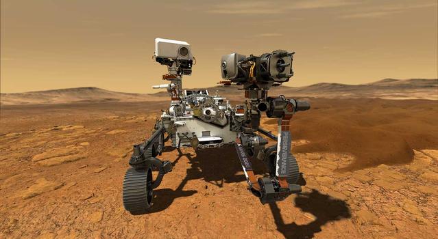
A key objective for Perseverance’s mission on Mars is astrobiology, including the search for signs of ancient microbial life. The rover will characterize the planet’s geology and past climate, pave the way for human exploration of the Red Planet, and be the first mission to collect and cache Martian rock and regolith (broken rock and dust).

Subsequent NASA missions, in cooperation with ESA (European Space Agency), would send spacecraft to Mars to collect these sealed samples from the surface and return them to Earth for in-depth analysis.

JPL built and manages operations of the Perseverance rover.

For more about Perseverance:

nasa.gov/perseverance

and

mars.nasa.gov/mars2020/